A guide to cycling and nordic walking routes in Pojezierze Brodnickie 2026: family loops, longer trails, rentals, JO Partners and QR codes.
Pojezierze Brodnickie od lat przyciąga miłośników dwóch kółek i kijków, ale sezon 2026 będzie szczególny. Dzięki projektowi Brodnickie JO trasy rowerowe i nordic walking zyskają wspólną mapę, partnerów po drodze i realne korzyści dla turystów.
Poniżej znajdziesz praktyczny przewodnik po tym, kiedy przyjechać, jakie wybrać trasy rowerowe Pojezierze Brodnickie 2026, gdzie pójść na nordic walking Bachotek trasa, a także jak skorzystać z kodów QR JO i lokalnych wypożyczalni.
Najlepszy sezon i warunki — kiedy wybrać się na trasę
Kiedy jest najlepszy czas na rower i nordic walking
Pojezierze Brodnickie jest atrakcyjne przez cały rok, ale dla rowerzystów i osób chodzących z kijkami najważniejsze są trzy okresy:
- April–June – cooler mornings, few mosquitoes, empty trails; ideal for longer Brodnica – nearby cycling routes and first nordic walking trainings.
- July–August – peak season, warm lake water, more families on the trails; a great time for shorter family loops and combining riding with beach time.
- September–October – golden autumn, stable weather, less traffic; the best moment for longer trips and calmly discovering new routes.
Trail conditions in 2026
In 2026 the municipalities of the lake district plan to:
- improve signage on key cycling routes (including areas around Brodnica, Zbiczno, Bachotek),
- update online maps as part of the Brodnickie.io portal and the Brodnickie JO program,
- develop points with JO QR codes at attractions, rental places and rest areas.
This will make it easier to plan your day: from a short family loop to a full-day ride with stops for swimming, coffee and local food.
Short family routes — description and map
1. Family loop “Bachotek – beach – forest” (bike + nordic walking)
- Length: approx. 8–10 km (variants)
- Start/finish: near the resorts on Bachotek lake
- Surface: forest roads, gravel, short asphalt sections
- For whom: families with children, beginners, nordic walking
This is one of the most popular suggestions for the nordic walking Bachotek trasa and a relaxed bike trip:
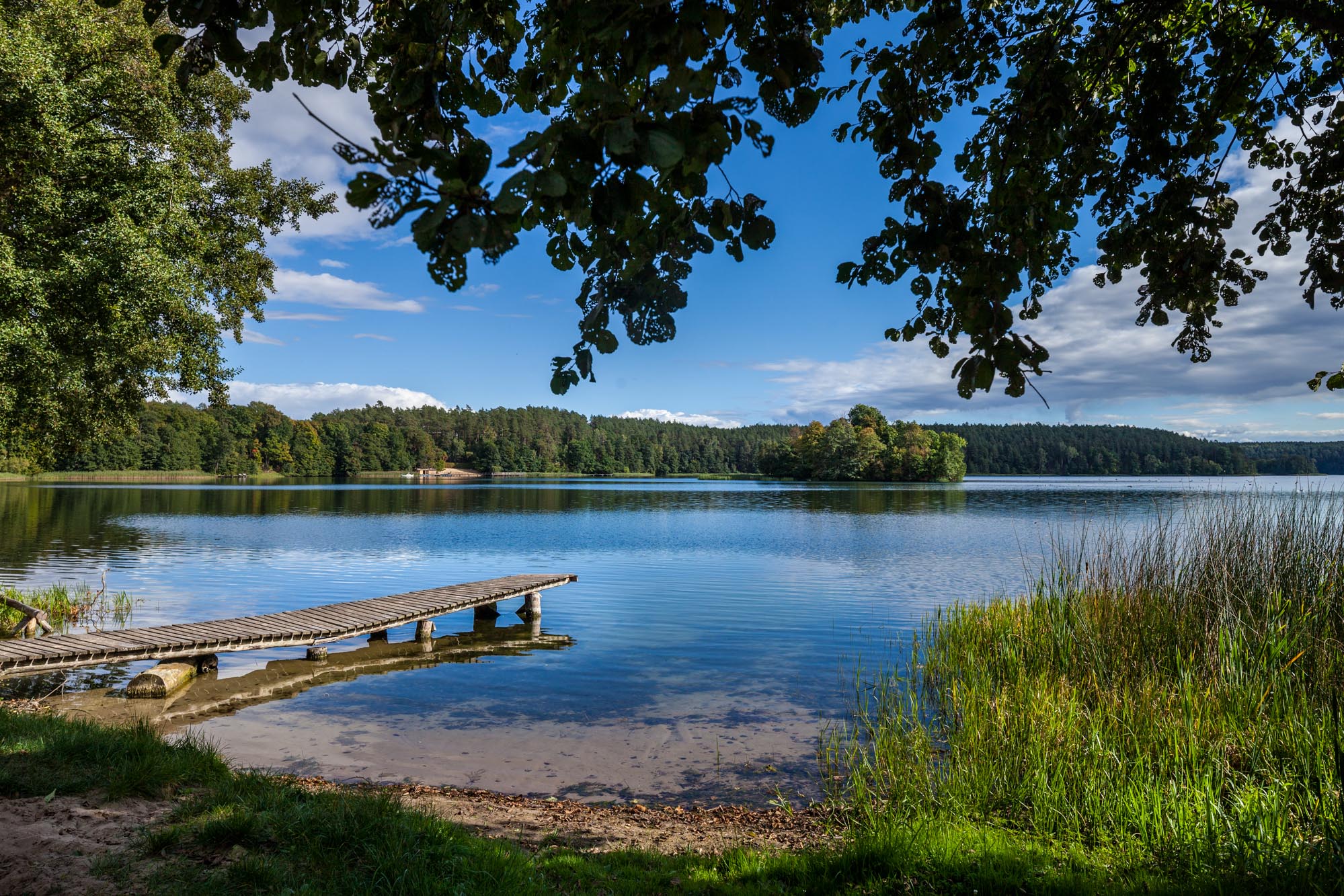
Example route: 1. Start at one of the Bachotek resorts (parking, toilets, often a playground). 2. Forest section along the lakeshore – a wide road, good for poles and children’s bikes. 3. Short stop at the beach (swimming, ice cream, coffee). 4. Return via an alternative forest road – the loop closes near the starting point.
What to note: - In 2026 map boards with JO maps and QR codes are planned at main forest entrances and beaches – scanning them will show suggested route variants, walking times and places with additional benefits. - The route is easy, but after rain there may be puddles – it’s worth having mudguards and shoes that can get dirty.
2. Short route “Brodnica – Niskie Brodno” (bike)
- Length: approx. 6–7 km one way
- Start: Brodnica town centre
- Finish: area around Niskie Brodno lake
- Surface: asphalt + hardened roads
This is a great option for families who want to combine sightseeing in Brodnica with a short trip to the lake.
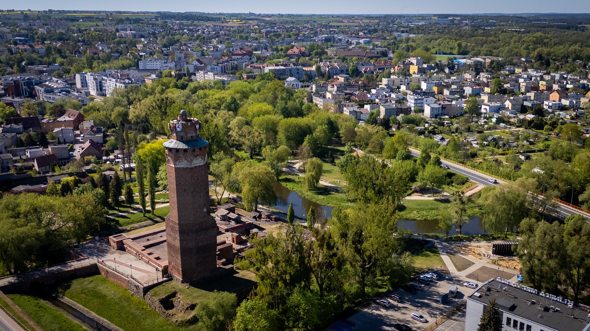
Example plan: - Start by the Teutonic castle or the market square in Brodnica. - Ride along the marked Brodnica cycling trails towards the lake. - Stop at the beach, playground, ice cream. - Return the same way or take a variant through other neighborhoods.
In 2026 look out for JO Partners on this route (cafés, ice cream shops, small food vendors) – by scanning their JO QR codes you can: - receive a small discount, - get a stamp/badge in the app, - receive recommendations for other family-friendly places.
Medium and long routes for active riders — difficulty and landmarks
3. Loop “Brodnica – Zbiczno – Bachotek – Brodnica” (bike)
- Length: approx. 40–50 km (depending on variant)
- Level: medium (for regular riders)
- Surface: asphalt, forest roads, gravel
This is a classic among the cycling routes Pojezierze Brodnickie 2026 – it connects the town, lakes and forests.
Approximate course: 1. Brodnica – start in the centre, possibility to rent a bike. 2. Ride towards Zbiczno – asphalt sections, good for warming up. 3. Section through forests and lakes towards Bachotek – here the route becomes more off-road. 4. Stop at Bachotek – swim, meal, short nordic walking walk. 5. Return via a different forest road or through smaller towns back to Brodnica.
Landmarks and breaks: - Zbiczno – shops, eateries, often local events. - Bachotek – beaches, holiday resorts, equipment rentals. - Along the way there are planned JO points with benches, bike racks and information boards.
4. Longer route “Trail of lakes and forests” (bike + JO 48 / JO Przygoda)
- Length: 60–80 km (over 1 or 2 days)
- Level: intermediate / advanced
- Character: connecting several municipalities, many lakes and attractions
This is a proposal for those who want to feel the whole region and use ready-made scenarios JO 48 (weekend) or JO Przygoda.
What such a trip might look like in 2026:
Day 1: start in Brodnica → ride past several lakes → overnight at a JO Partner (e.g. agritourism, guesthouse). Along the way you scan JO QR codes:
- you collect points for visited places,
- unlock small benefits (e.g. coffee with a meal, a local product to try).
Day 2: the rest of the route – more lakes, forest sections, return via a different road. The JO system suggests where it’s worth detouring from the main route to see a viewpoint or use another discount.
Why it’s worth it: - you visit several municipalities in one go instead of staying within one area, - you have consistent signage and a single map in the app, - you use local recommendations instead of random choices.
Service points and rentals — where to rent a bike/poles
Bike rentals
More and more rental points operate in the Pojezierze Brodnickie area, especially around:
- Brodnica – city bikes, trekking bikes, sometimes electric; often near the centre and main trails.
- Bachotek and nearby lakes – touring bikes, children’s bikes, child seats, trailers.
- Resorts in the Zbiczno municipality and neighboring communes – seasonal rentals tied to accommodation.
In 2026 many of them will be marked as JO Partners: - on the door or stand you will find a JO sticker and a QR code, - after scanning you’ll see available equipment, opening hours and possible benefits (e.g. discount for longer rentals).
Nordic walking pole rentals
Nordic walking poles can be rented e.g.:
- at selected Bachotek resorts (an ideal start for the nordic walking Bachotek trasa),
- at some guesthouses and agritourism farms – often as an extra service for guests,
- at JO points that specialize in active recreation.
It’s worth checking on Brodnickie.io before your arrival which places offer poles and if they are available on your dates.
Service points and self-service repair stations
On the main Brodnica and nearby cycling trails you will find:
- basic service points (bike workshops in town),
- self-service repair stations on selected routes – with a pump, tools and a bike hanger.
In 2026 these places are planned to be marked in the JO system: - on the map you’ll see where to repair your bike nearest, - after scanning the QR code at the station you may get a short video instruction (e.g. how to adjust brakes or fix a tube).
JO Partners and benefits along the way (QR codes)
Who are JO Partners
JO Partner is a local business or institution that joins the Brodnickie JO program and offers tourists a concrete benefit:
- accommodation,
- food services,
- attractions (e.g. canoe trips, rope parks),
- bike and pole rentals,
- guides, event organizers.
Each partner has its profile on the portal and is visible on the JO map.
How JO QR codes work on the trails
- You ride or walk the chosen route.
- You see a JO sign and a QR code (e.g. on a board, door, bike stand).
- You scan the code with your phone.
- The system records your visit and shows available benefits along the way.
Example benefits: - a discount on coffee or dessert for cyclists, - a free paper map when renting a bike, - a local product to try after completing a certain number of routes, - early check-in at accommodation for those arriving by bike.
JO 48 and JO Przygoda on cycling and nordic walking routes
- JO 48 – ready scenarios for 48 hours in the region, e.g. “Weekend on two wheels”, “Nordic walking and lakes”.
- JO Przygoda – longer challenges and routes that encourage visiting many places and collecting benefits.
Thanks to them: - you don’t have to plan everything yourself – you choose a ready scenario, - the system suggests which cycling routes Pojezierze Brodnickie 2026 and which nordic walking sections to connect, - along the way you use the JO Partners network.
Safety, signage and equipment preparation
Route signage in 2026
The municipalities of Pojezierze Brodnickie are working to ensure that:
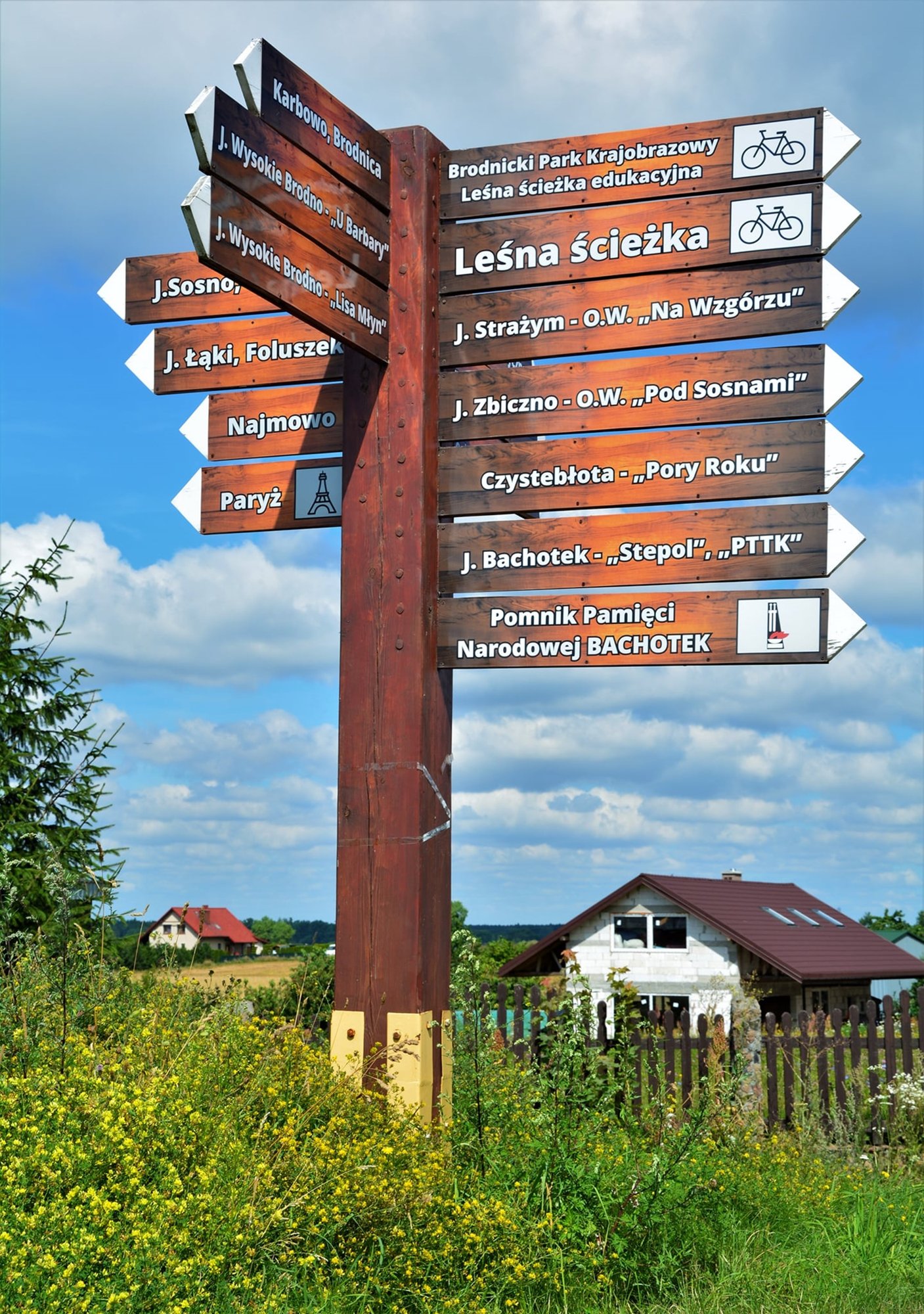
- Brodnica and nearby cycling trails are better marked with colors and pictograms,
- JO map boards and QR codes appear at key intersections,
- nordic walking trails (especially around Bachotek) have clear indications of length and difficulty level.
However, it’s always worth carrying: - an offline map (in the app or paper), - a charged phone with access to the Brodnickie.io portal.
Safety on the trail
A few practical rules:
- Helmet – mandatory for children, strongly recommended for adults.
- Lighting – it’s worth having lights even in summer; it gets dark quickly in the forest.
- Reflective elements – a vest or reflective items on the backpack.
- Water and snacks – on longer routes distances between shops can be greater.
- First aid kit – plasters, bandage, disinfectant.
For nordic walking pay attention to: - correct pole length, - shoes with a good sole (often forest, soft ground), - tick protection (spray, long socks, check after returning).
Equipment preparation
Before heading to Pojezierze Brodnickie in 2026:
- check brakes, gears, tires,
- bring a spare inner tube, tire levers, pump, basic multitool,
- if using a rental – make sure the bike fits your height.
For nordic walking poles: - check tip and basket fittings, - adjust length to your height (approx. 0.68 × height as a starting point).
Podsumowanie — odkryj trasy z Brodnickie JO i zapisz się na forum
Rok 2026 to dobry moment, aby na nowo odkryć trasy rowerowe Pojezierze Brodnickie 2026 i szlaki nordic walking wokół Bachotka. Dzięki projektowi Brodnickie JO:
- zyskasz jedną mapę regionu,
- skorzystasz z korzyści po drodze u JO Partnerów,
- łatwiej połączysz rower, nordic walking, nocleg i lokalne atrakcje.
Jeśli tworzysz ofertę turystyczną w regionie (noclegi, gastronomia, atrakcje, wypożyczalnie) i chcesz, aby Twoje miejsce było widoczne na trasach:
- wejdź na https://brodnickie.io,
- zapisz się na I Forum Turystyki — Pojezierze Brodnickie (21 października 2026, godz. 10:00, GOKSiR w Zbicznie),
- poznaj szczegóły projektu Brodnickie JO i zdecyduj, czy chcesz dołączyć.
Im więcej partnerów i dobrze opisanych tras, tym ciekawsze i bardziej różnorodne stanie się Pojezierze Brodnickie dla rowerzystów i miłośników nordic walking – przez 365 days a year.